Wielkopolska Digital Library contains 418 165 digital objects
Object
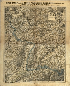
Title: Justus Perthes' Karte der deutsch-französischen Grenzländer von Köln bis Bern und von Metz bis Ulm : Mit Special Cartons der Festungen: Mainz, Saarlouis, Landau, Gemersheim, Rastatt, Ulm
Contributor:
Vogel, Karl (1828-1897) ; Petermann, August (1822-1878)
Description:
1:925 000 ; 1 ark.: litogr., granice kolor.; 40,5x49,5 cm. ; Rzeźba terenu oddana metodą kreskowania.
Publisher:
Place of publication:
Signature:
Language:
Rights:
Access rights:
Digitisation:
Location of original object:
Object collections:
- Digital Library of Wielkopolska > Digital Library of Wielkopolska > Cultural heritage
- Digital Library of Wielkopolska > Instytucje współtworzące > Biblioteka Kórnicka PAN
Last modified:
Feb 22, 2022
In our library since:
Feb 22, 2022
Number of object content hits:
14
All available object's versions:
https://wbc.poznan.pl/publication/598516
Show description in RDF format:
Show description in OAI-PMH format:
Objects Similar
[1899]
sprawozdania
Kahle, Carl Moriz
1845
szkice
Hinrichs, Hermann Friedrich Wilhelm (1794–1861)
1845
szkice
Bickelmann, Georg Conrad
1836
poradniki
×

